Weather Sticker

Click for Mayo, Yukon Territory Forecast

Monday, October 31, 2011

Air Masses, the Polar Jet Stream and Orographic Blocking


Mayo Village's weather is influenced by both arctic and polar fronting. The polar front is the boundary between the cold, polar air masses and warm tropical air masses.  As the temperature gradient between these air masses increases so does the potential for cyclogenesis. The arctic front, like the polar front, is dependent on temperature gradients between air masses. Arctic fronting typically produces precipitation in the form of snow. The Arctic front effects Mayo Village the most during spring and autumn by enhancing cloudiness.

Graphic Source: Air Masses. National Weather Service JetStream-Online School for Weather. NOAA. Updated: 2010 January 5. Accessed: 2011 October 22. http://www.srh.noaa.gov/jetstream/synoptic/airmass.htm

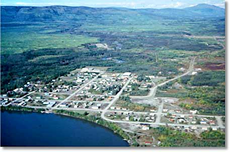
http://www.packyabags.com/canada/rubyrange/14daywinter.htm 
Mayo Village is located above polar latitudinal delineation of 60° N. The weather in this area is primarily induced by the continental polar air mass stimulated by radiational cooling. These air masses originate from the snow covered interior of Canada and effects on this province are cold, dry weather motivating stable atmospheric conditions. The cold front boundary strengthens and migrates south in the winter, weakening and migrating north in the summer.  Continental tropical air never quite makes it up to Mayo except during particular decadal oscillations, in which weak occlusion during the summertime can occur. Weak, cold type occlusion occurs in the summertime if mP air surpasses the coastal range.  
In the winter, the cold airs mass freezes the ground and cools the overlying air column up to 1 km, condensing moisture in the air onto the snow surface. With coldest temperatures located near the surface strong temperature inversion occurs and there is little mixing of the air column. These conditions are unfavorable for precipitation, and, what little moisture that does come from the atmosphere condenses as snow. This cold, dry air mass travels south easterly into North America becoming unstable at lower layers, eventually warming and  gaining moisture. 
Graphic Source: Air Masses and Fronts. Firemodels.org. Accessed: 2011 October 22. http://www.firemodels.org/downloads/.../pms_425_Fire_Wx_ch_08.pdf


In the summer increased solar radiation results in a relatively little surface cooling, weakly enhancing the temperature of air column near the ground. Results are relatively unstable conditions in the lower layers of air column. Dry conditions of the ground surface up to a high altitude of the air column would  tend to result in lack of cloudiness or precipitation, but as observed in the graphic below, this is not the case in Mayo.

Graphic Source: Air Masses and Fronts. Firemodels.org. Accessed: 2011 October 22. http://www.firemodels.org/downloads/.../pms_425_Fire_Wx_ch_08.pdf


Mayo Village, surrounded by water in various forms, observes enhanced precipitation and weak cyclonic activity in the summer. The increased sunlight and melting of semi permanent ground allows Mayo to thrive with vegetation that escalates moisture content of the air through the process of transpiration and evaporation from the water bodies that surround the area; increasing precipitation and cloudiness. 
Graphic Source: Water Cycle. 2011. Yukon Water. Government of Yukon. Last Updated: 2011 MAY 5. Accessed: 2011 OCT 22.


Here are the weather maps (water vapor, wind direction, water saturation, etc) for Mayo Village for October 29 2011. Illustrated is current jet stream location and orographic blocking on southwestern border of Yukon. The polar jet stream migrates south during the winter and north during the summer. Mayo Village rarely observes summer temperatures higher than 80 F.

Graphics Source: Satellite Images (data courtesy of NOAA). Weather Office, Canada. Updated: 2011 OCT 12. Accessed: 2011 OCT 29. http://www.weatheroffice.gc.ca/satellite/index_e.html


The northern tip of the Rocky Mountain/Pacific Cordillera and the St Elias Mountain Range lie to the southwest of Mayo Village along the Yukon/Alaska border. The range prevents the moist maritime polar air from intruding Mayo Village via orographic blocking. The boundary between the cP (darker blue) and mP (turquoise blue) air masses can be observed to the southwest of the mountain ranges. 

Graphic Source: What is an air mass? 2011. Wheatherquestions.com /Weatherstreet.com. Accessed: 2011 OCT 31. http://www.weatherquestions.com/What_is_an_air_mass.htm


Adiabatically heated air rushes down the lee side of the St Elias Mtn Range, enhancing dry conditions  experince in Mayo Village during wintertime. 

Chinook Wind. Wikipedia, the free encyclopedia. Updated: 2011 OCT 8. Accessed: 2011 OCT 31.  http://en.wikipedia.org/wiki/Chinook_wind

Graphic Source: St. Elias Mountains, Kluane National Park, Yukon Territory, Canada. Radius/SuperStock. Accessed: 2011 OCT 31. http://www.superstock.com/stock-photography/Saint+Elias+Mountains


Polar vorticity consists of persistent large scale cyclonic activity in the mid- troposphere to shallow stratosphere, centered in polar regions of North and South Hemisphere. The Arctic Vortex, the northern polar vortex,  disturbs weather patterns particularly in the eastern part of North America, and, only skims the edge of the Yukon. Therefore the Arctic Vortex has relatively weak effects on weather in Mayo. 
Tyrsina R. 10 Differences Between the North and South Poles. Science and Nature, Ultimate Listverse. 2011 JUN 19. Accessed: 2011 OCT 31 . http://listverse.com/2011/06/19/10-differences-between-the-north-and-south-poles/
Additional Sources:

Arctic Climatology and Meteorology Education Center.  National Snow and Ice Data Center.  Accessed: 2011 OCT 29. http://nsidc.org/arcticmet/

Lutgens, F.K. Tarbuck E.J. 2010. The Atmosphere: An Introduction to Meteorology.  Pearson Education. Chapters: 4, 6, 7, 9. 


Tuesday, October 18, 2011

Introducing Weather and Climate of Mayo, YT


Mayo Connections. Accessed: 2011 October 16. http


Mayo Village (elevation 1654 ft, lat 63.6°, long 135.9° W) is a subarctic, continental polar region within Canada's Yukon Territory. This tiny civic center is famed in the Yukon for being the "coldest and driest" during the winter and the "hottest and most wet" during the summer. Mayo's annual average is 29° F with an average precipitation of 1.1 in the form of rain, 5 in in the form of snow, and an annual range hovering around 70° F (wow!). The village sits in a polar "heat sink" zone; an area where the concentrated energy of the equator is dissipated on its journey toward the poles. 
Mayo A., YT Canada: Climat, Global Warming and Daylights Charts and Data. 2010 Climate-charts.com Accessed: 2011 October 16. http://www.climate-charts.com/Locations/c/CN71965021007000.php

Mayo earns the fame of being the "coldest and driest" due to the lack of sunlight, a semi permanent overlying pressure ridge, and the orographic effect.  The azimuth at solar noon on the winter solstice (December 21/22) is at a very low angle of 4.09°. The low angle is related to the earths location on the ecliptic plane and the perpendicular tilt of 23.5° , which causes Mayo to be outside the circle of illumination. Therefore, Mayo experiences long winter nights with little to no sunlight during the day. A diminutive, anticyclonic pressure system, referred to as the Yukon/North American High, hovers over the Yukon and instigates stable winters in Mayo with little precipitation and intensely cold temperatures. To the west of Mayo lies the Pacific Cordillera, the northernmost part of the Rocky Mountain Range. The range acts as a topographic barrier that forces water vapor to condense via adiabatic cooling on the windward side, leaving the lee devoid of moisture. The annual average minimum temperature of -24° F (BRR!) occurs in Mayo during the wintery month of January. 
Data Source:Mayo, Yukon Territory Climate Guide. Climatetemp.info. Updated: 2011 July 22. Accessed: 2011 October 15. http://www.climatetemp.info/canada/mayo-yukon-territory.html


The summers in Mayo are warmer and wetter than the winters as a result of an intense increase in sunlight and weak cyclonic activity. The annual average maximum temperature of 72° F occurs in Mayo during the month of July. As the earth migrates along it's ecliptic, so moves the village of Mayo completely within the circle of illumination. The azimuth at solar noon on the summer solstice (June 21/22) is at an angle of 48.5°, which is 10X greater than the solar angle during winter solstice.  This allows the summer to be dominated by long days of sunlight (about 20 hours) with a brief twilight period (about 4 hours). 


The increased precipitation, sunlight, and melting of the semi permanent ground during the summer months bring a very 
diverse flora and fauna to the region including birch, swamp spruce, wildflowers, mosses, multiple fungi, fish, wolves, migratory birds, bears and caribou. Photo by Qwyla Foutch


Mayo is located on the confluence of Mayo and Stewart River, 330 miles south of the Beaufort Sea in the Arctic Ocean, and 200 miles to the North East of the Gulf of Alaska in the Pacific Ocean. The Canadian/Pacific Cordillera (northernmost part of the Rocky Mountain Range) lies to the west of Mayo. This is very important physical barrier that enhances drier conditions by blocking precipitation from the Aleutian Low Pressure system via the orographic effect. Other mountain ranges nearby include St. Elias Mountain Range located to the south west on the Alaskan border and the Mackenzie Mountain Range located to the north east on the North West Territory border. Mayo is classified as taiga/boreal forests that are associated with cordillera ranges. 
(Maps: Yukon Topography. Resources: Yukon Chapter. Canadian Parks and Wilderness Society. Accessed: 2011 October 16. http://www.cpawsyukon.org/resources/map-yukon-topography.html)


Amusingly, the Beaufort Sea contains an important ocean circulation known as the Beaufort Gyre. The North Atlantic Current fuels this circulation as warm water is transported to the Arctic Ocean from the equator. The gyre is driven by an overlaying clockwise circulation caused by the movement of the Polar Easterlies that spawns a high-pressure ridge known as the Arctic/Beaufort High located north of Alaska.  This anticyclone connects the Siberian pressure ridge with the Yukon pressure ridge. This system weakens in the summer.
(Arctic Ocean Circulation. Woods Hole Oceanographic Institution. 2007. Updated: 2011, September 28. Accessed: 2011 October 14

During El Nino/Southern Oscillation the S. Pacific subtropical high located off the west coast of South America does not strengthen as normal causing a reversal in in the Walker circulation of the atmosphere. The trade winds are therefore weakened (sometimes reversed) and do not transport moisture to the east Pacific as effectively. ENSO includes a strong countercurrent that pushes warm water back to the western coast of South and Central America, diminishing the Peruvian current that encourages upwelling of cold nutrient filled water. ENSO does not dramatically effect the Yukon, as indicated by a small increase in Mayo's winter temperatures.
(NOAA El Nino Forecast. Harvey Road New York State Ski Blog. Harvey Road. Updated: 2009 July 30. Accessed: 2011 October 15. http://www.nyskiblog.com/2009_07_01_archive.html)

When  La Nina occurs, the S.Pacific subtropical high strengthens more than normal causing an enhanced equatorial current that transports warm water to the east Pacific, and increases the strength of the low pressure system over South East Asia and Australia. Surface temperatures in the Pacific Ocean are colder than average, and winters in Mayo reflect increased precipitation and decreased temperatures caused by enhanced jet stream activity.
 (NOAA El Nino Forecast. Harvey Road New York State Ski Blog. Harvey Road. Updated: 2009 July 30. Accessed: 2011 October 15. http://www.nyskiblog.com/2009_07_01_archive.html)

Additional Sources:

Arctic Ocean Cirulation. Woods Hole Oceanographic Institution. 2007. Updated: 2011, September 28. Accessed: 2011 October 14
Arctic theme page. National Oceanic and Atmospheric Administration. Accessed 2011 October 14. http://www.arctic.noaa.gov/gallery_np_seasons.html

Bernhardt T. Boreal Cordillera. The Canadian Biodiversity Web Site. Accessed: 2011 October 15. http://canadianbiodiversity.mcgill.ca/english/ecozones/borealcordillera/borealcordillera.htm


Curry J. On the formation of continental polar air. 1982. Journal of Atmospheric Sciences. Vol:40 2278. Accessed: 2011 October 16. http://curry.eas.gatech.edu/currydoc/Curry_JAS40.pdf

Mayo A., YT Canada: Climat, Global Warming and Daylights Charts and Data. 2010 Climate-charts.com Accessed: 2011 October 16. http://www.climate-charts.com/Locations/c/CN71965021007000.php

 Processes: Dynamics: Circulation. All about Sea Ice. National Snow and Ice Data Center. Accessed: 2011 October 14. http://nsidc.org/seaice/processes/circulation.html